


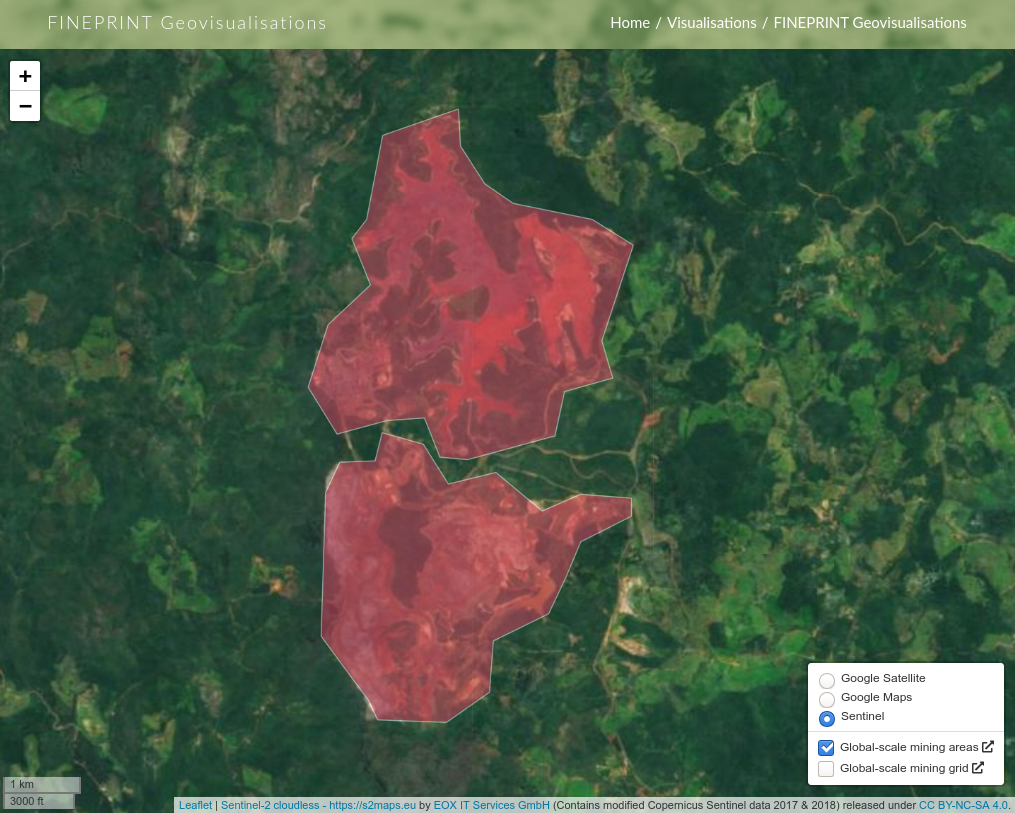
FINEPRINT Geovisualisations provide an interface to visualise global, geospatial data, such as land areas from surface mining and deforestation.
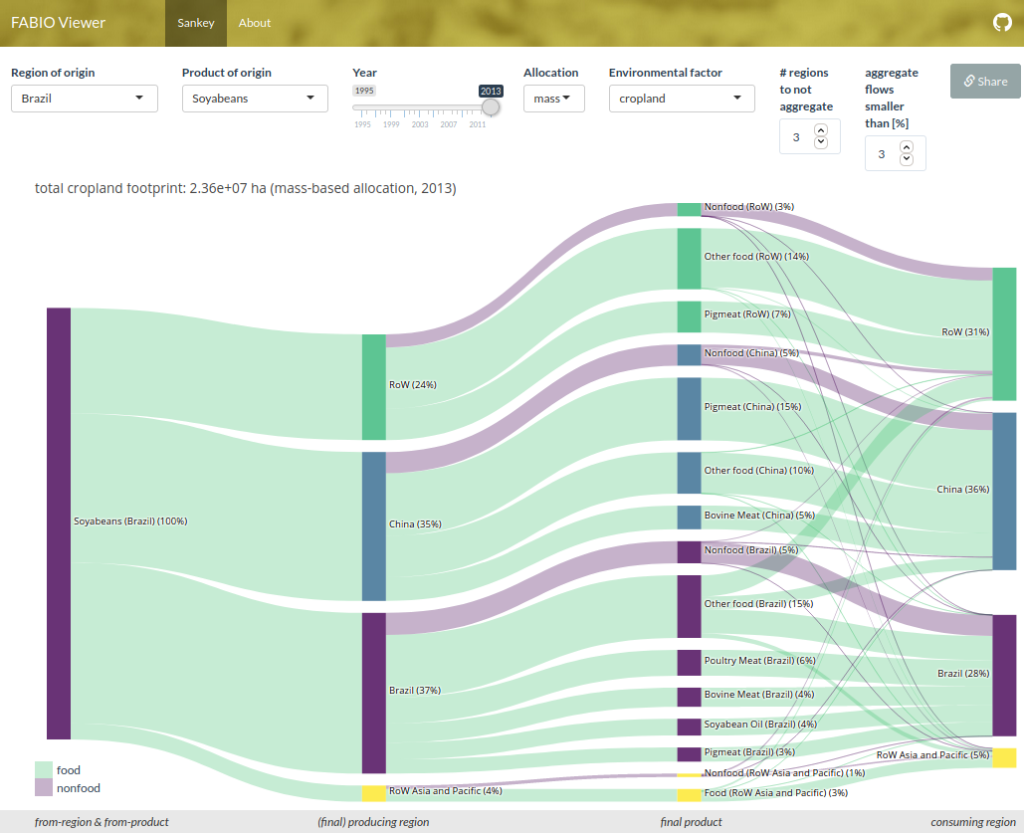
The FABIO Sankey Tool allows visualising the global supply chains of a wide range of agricultural products from the producing to the consuming country.
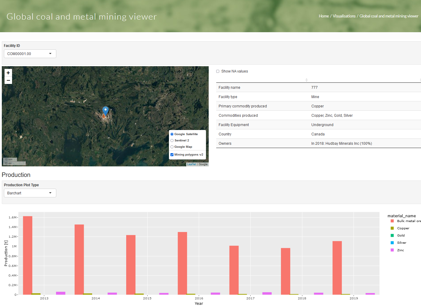
The global coal and metal mining viewer allows users to view location, information, and production data for individual mines.