


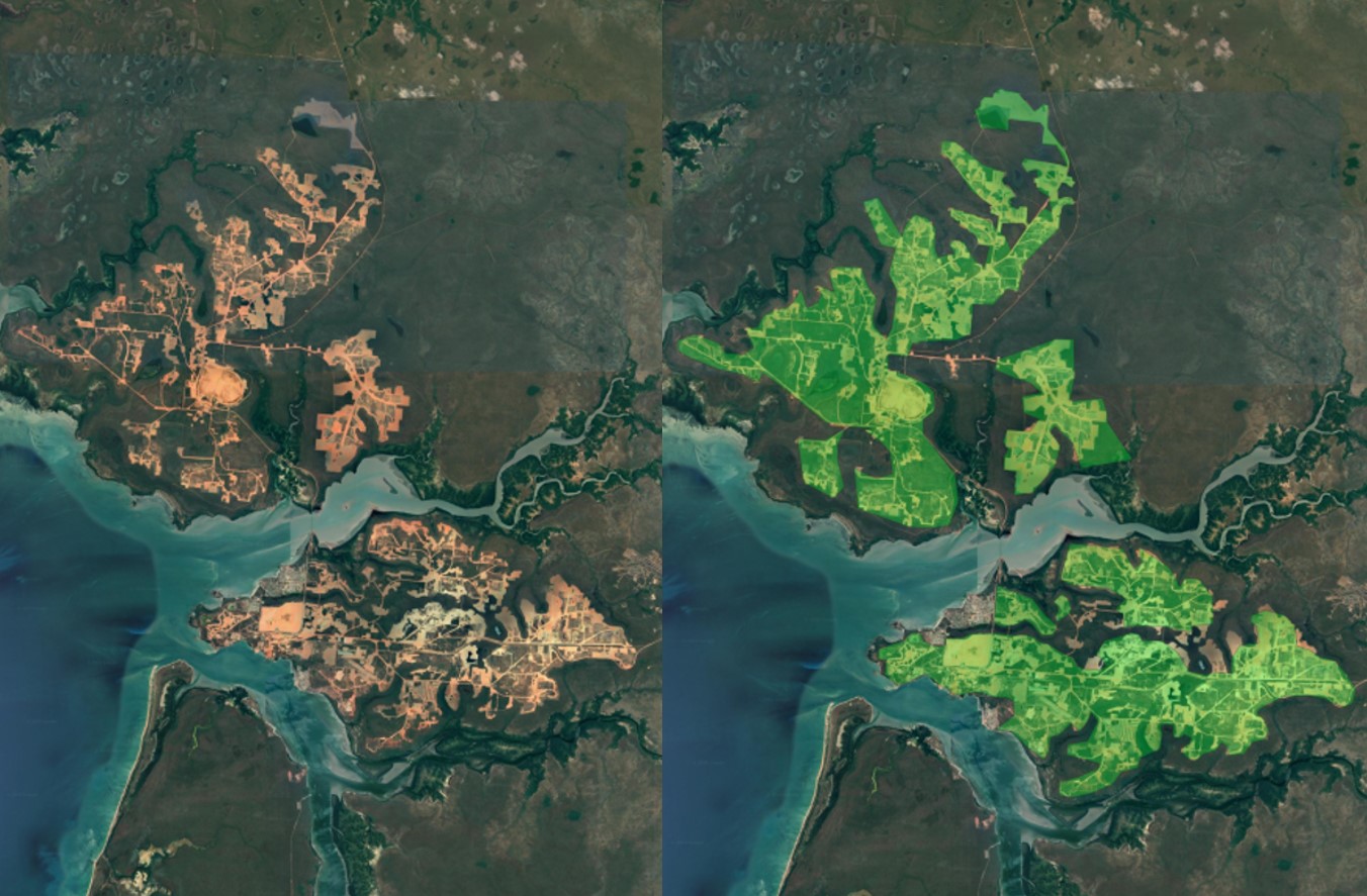
Based on satellite imagery sources, we develop data sets containing georeferenced polygons of more than 34,000 mines on a world-wide scale, illustrating the land use of the global mining sector.
FABIO provides a set of multi-regional physical supply-use and input-output tables to trace agriculture and forestry products along global supply chains.
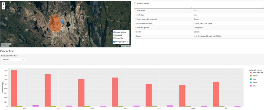
The open database on global coal and metal mine production provides a comprehensive collection of mining data, primarily covering physical production data of coal and metal ores on an individual mine level.